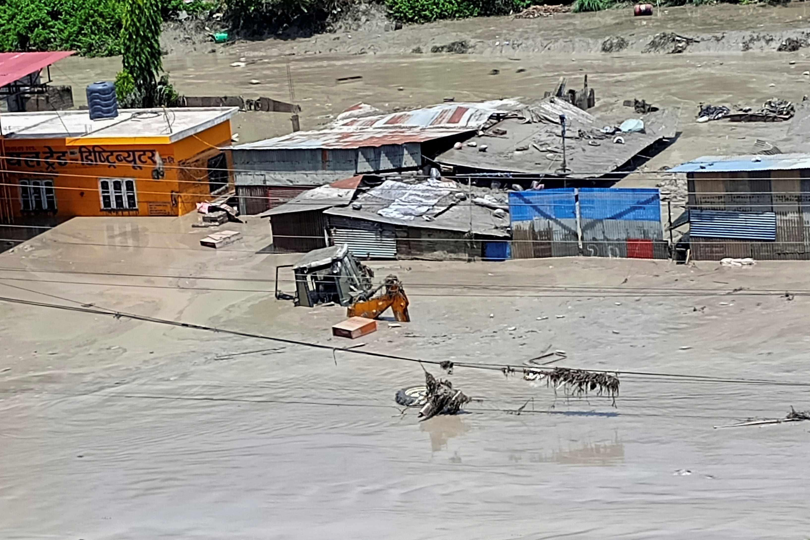
Transboundary river systems in high-altitude mountain environments operate as high-velocity energy transfer channels where hydrological shocks cross national borders with minimal response time. The flash flood event on the Bhote Koshi River originating from the Tibetan region into Nepal's Rasuwa district illustrates the structural vulnerability of narrow gorge corridors. By examining the physical drivers, telemetry failures, and asset exposure metrics of this disaster, we can deconstruct the mechanics behind catastrophic loss of life and infrastructure collapse.
The Physical Mechanics of Transboundary Surges
A flash flood of this magnitude is not merely an accumulation of heavy rainfall; it represents a discrete kinetic energy release. Geological surveys and seismological data indicate a primary trigger mechanism involving an localized seismic event—specifically a 4.4-magnitude earthquake registered by the German Research Centre for Geosciences—acting seven minutes prior to the physical surge visible in security footage. This seismic shock induced an avalanche or landslide on the Tibetan side, creating a temporary natural dam across the upstream channel.
When such debris blockages fail, they create a dam-break wave governed by the Ritter equation for idealized dam breaks. The sudden release transforms static potential energy into kinetic discharge, sending a wall of water, mud, and boulders downstream at exponential velocities. Because the upper catchment lies within Tibet while the primary impact zones—such as Timure and Syapru Besi—sit within Nepal, the time lag between initiation and impact is measured in minutes rather than hours. This structural compression of time invalidates conventional downstream warning models that rely on manual observation or standard rain-gauge telemetry.
Infrastructure Vulnerability and Asset Exposure
The physical footprint of the disaster exposes critical flaws in regional civil engineering along high-gradient river basins. The destruction of the newly constructed Friendship Bridge at Rasuwagadhi, alongside multiple bridges spanning the Trishuli-Bhote Koshi network, demonstrates that design standards in these corridors frequently underestimate peak bedload transport. When a flood carries millions of tons of hyper-concentrated sediment and boulders, standard hydraulic load calculations based strictly on fluid volume fail. The actual destructive force scales with solid-liquid density ratios, turning rivers into kinetic battering rams.
Power generation infrastructure bears an equally severe cost function. Approximately 430 megawatts of electricity supply was disrupted across multiple hydropower projects, accounting for over twelve percent of the nation's installed capacity. Run-of-river hydropower facilities in narrow gorges lack large reservoir buffers, leaving their intake structures, desand basins, and electromechanical equipment directly exposed to bedload surges. The economic toll extends beyond immediate asset write-offs to regional grid instability and long-term capital replacement loops.
Telemetry Gaps and the Human Cost Function
The casualty and missing person metrics—including dozens of missing security personnel from the Nepal Police and Armed Police Force, alongside hundreds of unaccounted tourists and pilgrims—highlight a systemic failure in institutional deployment logic. Border outposts and customs stations are historically sited near river convergence points and trade choke points for logistical convenience. However, in high-risk tectonic zones, these administrative hubs sit directly within the hydraulic risk zone of least resistance.
The absence of real-time, cross-border hydro-meteorological data sharing between upstream and downstream authorities creates an operational blind spot. Without automated seismic sensors linked directly to acoustic sirens in downstream gorges, security personnel and civilian populations operate under informational asymmetry. The time window between the initial Tibetan-side release and impact at Timure Bazaar was functionally zero for unprotected personnel, converting an unmonitored hydrological anomaly into a high-casualty event.
Upstream Monitoring Integration and Hydro-Risk Redesign
Mitigating future transboundary disasters requires shifting from reactive rescue operations to predictive hydraulic architecture. Regional disaster management frameworks must decouple early warning systems from manual cross-border diplomatic communications by installing automated, satellite-linked sensor arrays at high-altitude glacial lakes and landslide-prone tributaries.
Civil engineering protocols within the Bhote Koshi and Trishuli corridors must mandate setback requirements for all public infrastructure, moving security installations and market hubs out of active alluvial fans. Hydropower developers must incorporate sediment-bypass mechanisms and rapid-closure intake gates designed to withstand hyper-concentrated debris flows, ensuring that structural survival rates scale proportionally with tectonic and meteorological volatility.