A container ship called the MSC Antonia is cruising through the Persian Gulf when its onboard navigation screen suddenly claims the massive vessel is sitting on dry land inside Iran. At the exact same time, a food delivery driver in downtown Dubai looks at his phone and watches his route line dissolve, placing him miles out at sea. Meanwhile, commercial airliners are flying in bizarre, wave-like zigzags over one of the busiest air corridors on earth.
This isn't a sci-fi movie. It's the daily reality of the electronic warfare arms race triggered by the escalation of the Iran war.
Ever since the heavy strikes on February 28, the airspace and waters around the Strait of Hormuz have become an invisible swamp of radio frequency chaos. Over a million GPS jamming incidents have hit the region. Everyone is doing it. The US, Israel, Iran, and local Gulf states are all blasting the spectrum with interference.
If you think GPS is an unshakeable global utility, the crisis in the Middle East proves we've been living in a fool's paradise.
The Absolute Fragility of Satellite Navigation
To understand why this is happening, you have to look at how GPS works. Or rather, how weak it is.
Global Navigation Satellite System (GNSS) signals originate from satellites orbiting roughly 20,000 kilometers above Earth. By the time those radio waves reach your smartphone, a ship's console, or a missile's guidance system, they're incredibly faint. They're weaker than the ambient background noise of the planet.
It doesn't take a multi-billion-dollar military apparatus to override that signal. A relatively cheap, ground-based transmitter pumping out a bit of power on the same frequency can easily shout down the satellite.
There are two main flavors to this invisible warfare:
- Jamming: This is basic brute force. A transmitter blasts random noise on the GPS frequency, blinding every receiver in the area. Your device simply freezes or shows "No Signal."
- Spoofing: This is much more sinister. Instead of blocking the signal, a transmitter sends out fake data that mimics real satellites. The receiver believes the fake signal, recalculating its position to somewhere entirely different.
Military forces across the region aren't doing this to annoy gig workers or mess with shipping companies. They're doing it for survival. When an adversary launches a flock of explosive drones or guided missiles, those weapons rely heavily on GPS coordinates to hit their targets. By flooding the local airspace with false location data, defensive electronic systems trick the incoming missiles into veering off course, crashing harmlessly into the sea or empty desert.
The problem? Radio waves don't care about borders. High-powered military jamming spills over into civilian infrastructure with catastrophic efficiency.
Chaos on the High Seas and Shifting Targets
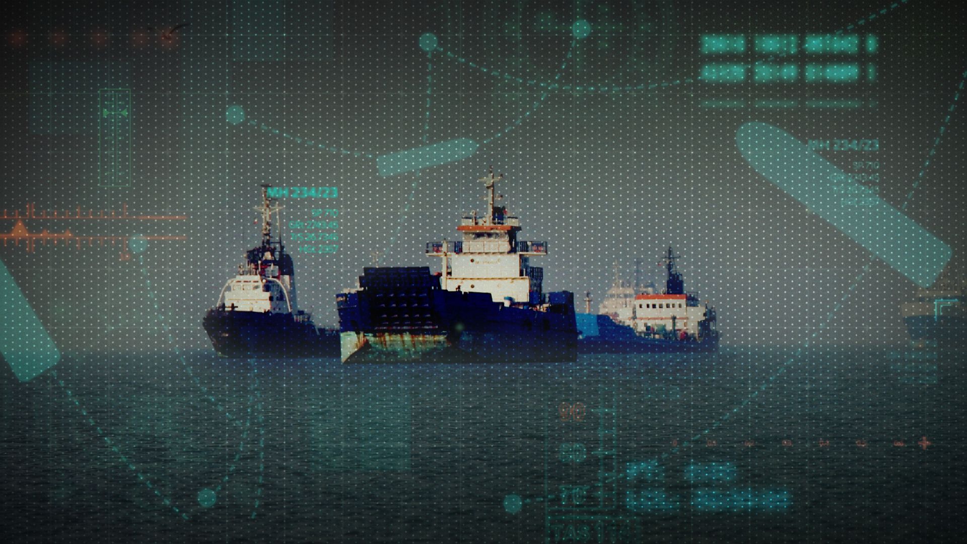
Maritime intelligence firm Windward logged over 1,100 vessels experiencing severe GPS interference within just 24 hours of the conflict’s major escalation. Within weeks, that number spiked by over 55%, affecting thousands of vessels across Qatari, Emirati, Saudi, and Omani waters.
Ships rely on the Automatic Identification System (AIS) to broadcast their position and avoid colliding with other massive vessels. In congested waters like the Strait of Hormuz, where 300-meter oil tankers require miles of open water just to slow down or turn, knowing where everyone else is going is a matter of life and death.
Instead, the region's AIS maps look like an abstract painting. Ships are showing up inside international airports, hovering over Iranian nuclear facilities, or tracing crop-circle patterns in the water.
[Normal Navigation Data] ---> [Military Jammer/Spoofer] ---> [Scrambled AIS Output]
                                                                  |--> Vessels placed inland
                                                                  |--> Errant flight paths
                                                                  |--> Total signal loss
This isn't just a navigation hazard; it's a massive compliance nightmare. When an oil tanker’s GPS suddenly places it inside an Iranian port due to spoofing, it triggers automated compliance alerts for banks, insurers, and charterers. Suddenly, a perfectly legitimate Western company looks like it's violating international sanctions. Tanker traffic through the world's most critical energy corridor has slowed significantly, with many captains choosing to run "dark"—turning off their tracking entirely—rather than dealing with the electronic pollution.
How to Navigate a Denied Environment
If you are operating logistics, shipping, or aviation assets through the Middle East right now, relying on standard GPS is a recipe for disaster. The electronic warfare arms race isn't winding down; it's intensifying. Think tank experts from organizations like the Royal United Services Institute (RUSI) point out that Iran is rapidly deploying domestically produced and Chinese-sourced electronic warfare suites, while US forces are countered with their own localized defensive bubbles.
You can't count on the signal coming back. Here is how industries are keeping operations alive in a GPS-denied environment.
1. Revert to Analog Maritime Redundancy
Captains in the Gulf are dusting off traditional seafaring skills. You have to cross-check every digital readout with radar, visual piloting, and depth soundings. If your digital map shows a clear channel but your radar indicates a shoreline, trust the radar. Never let automated systems make course corrections without manual human verification.
2. Implement Assured PNT (Positioning, Navigation, and Timing)
For defense contractors and logistics firms, Assured PNT architectures are moving from a future upgrade to a current operational requirement. This means installing anti-jam antennas that use controlled reception pattern technology to physically block interference coming from the horizon while focusing only on the sky.
3. Transition to Optical and Inertial Systems
The ultimate defense against radio frequency jamming is to stop using radio waves entirely. High-end drones and aircraft are switching to passive optical navigation. These systems use real-time terrain correlation—basically looking at the ground with cameras and comparing the imagery to onboard maps—to find their way. Because it doesn't transmit or receive signals, optical navigation is completely immune to electronic warfare.
The conflict has permanently shattered the illusion of a secure, always-on global positioning network. Whether you're flying a commercial airliner, piloting an oil tanker, or just trying to deliver groceries in Dubai, the ground rules have changed. If your operations depend on a weak signal from space, it's time to build a backup plan that doesn't look at the sky.


_Biopsy.png?branch=uat_release_3)
