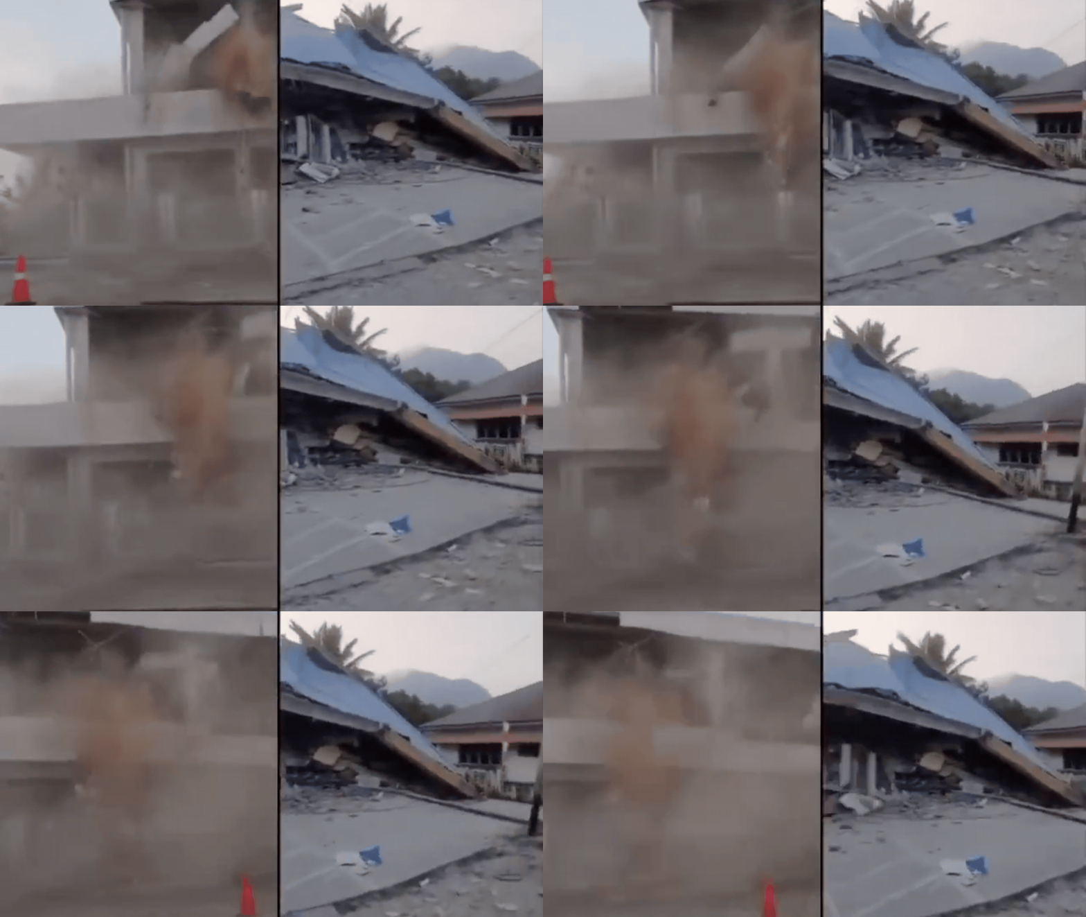
The ground starts to shake, and you have seconds to decide whether your home will become your tomb. That reality hit eastern Indonesia when a violent 7.7-magnitude earthquake struck off the coast of Flores Island. At least 38 people lost their lives, buildings crumbled into dust, and terrified residents scrambled for higher ground.
If you track seismic activity globally, you know Indonesia sits squarely on the Pacific Ring of Fire. Tectonic plates grind against each other here constantly. But scale matters. A 7.7-magnitude tremor at a shallow depth of just 10 kilometers packs a punch that ordinary infrastructure simply cannot shrug off.
The Anatomy of the Flores Disaster
The US Geological Survey pinned the epicenter about 68 kilometers north-northwest of Ende in the East Nusa Tenggara province. When it hit early in the morning, people were still waking up. In Sikka regency, the waiting room at the Maumere port terminal pancaked into a pile of rubble. At St. Peter Major Seminary, students and nuns fled for their lives as the roof of their assembly hall collapsed during morning prayers. One priest broke a leg after jumping from a second-story window to escape the falling concrete.
Landslides proved just as lethal as the initial shaking. Tons of mud and rock broke loose from hillsides in Reok village, burying victims and cutting off vital transport routes. The Trans-Flores highway—a crucial 700-kilometer mountain artery linking communities across the island—blocked emergency responders trying to reach the hardest-hit areas near Nagekeo.
Power grids failed immediately. Communication lines went dark, leaving local officials blindfolded while trying to coordinate rescue dispatches. Hospitals took heavy hits too. Staff hauled beds, IV drips, and oxygen cylinders out onto lawns and streets because structural damage made treating patients indoors too risky.
The Tsunami Panic and Evacuation Reality
Minutes after the main shock, the Meteorology, Climatology and Geophysics Agency issued an urgent tsunami warning. People living near beaches and riverbanks heard sirens and fled toward the hills. Around 2,000 villagers in Nagekeo abandoned their homes entirely, seeking safety in temporary makeshift shelters.
Fortunately, subsequent monitoring showed no massive sea-level spikes, and authorities lifted the tsunami alert about three hours later. Still, false alarms save lives in regions scarred by history. Older residents remember the catastrophic 1992 Flores earthquake and tsunami that claimed thousands of lives. Nobody wants to gamble with the ocean here anymore.
Why Vulnerability Persists
Disaster management agencies like the BNPB deployed helicopters and rescue vessels to bypass the blocked roads and fragmented island geography. Yet, emergency response logistics always lag behind initial impacts when rugged terrain meets massive structural failure.
Building codes remain a persistent weak spot across many developing seismic zones. Concrete structures without proper steel reinforcement turn into traps during high-magnitude shaking. Until engineering standards catch up with geological realities, earthquakes like this one will continue to turn morning routines into humanitarian crises.
Check your local emergency preparedness plans today. If you live in an active seismic zone, keep a go-bag packed with water, first aid supplies, and copies of essential documents. When the earth starts moving, preparation is the only advantage you get.