A profound meteorological split is tearing across the United States. While the Pacific Northwest and northern Rocky Mountains struggle under unseasonal, low-elevation summer snow, the eastern half of the nation is preparing for a dangerous heat dome that threatens to push temperatures up to 40 degrees Celsius in major metropolitan hubs. This extreme contrast is not a coincidence. It is the direct consequence of a severely buckled jet stream that is locking starkly opposing weather patterns into place simultaneously. The resulting pressure systems are exposing severe vulnerabilities in regional infrastructure and challenging traditional models of seasonal predictability.
The current atmosphere presents a study in absolute contradictions. Over the weekend, a massive cold front originating from the northern Pacific pushed deep into the Western United States. It brought a drastic, sudden drop in temperatures across a region that had spent the preceding weeks dealing with intense early-summer heat and prolonged drought conditions. Temperatures from the Canadian border down through parts of northern California fell significantly, dropping five to ten degrees below historical averages for late June. In areas further north, the deviation was even more extreme.
The Mechanics of a Fractured Sky
The core of this weather anomaly lies in the behavior of the polar jet stream. Under normal conditions, this high-altitude band of wind moves relatively predictably from west to east, keeping colder arctic air isolated to the north and warmer air to the south. Right now, that ribbon of air is behaving like a fraying rope. It has warped into a series of massive, slow-moving waves that loop thousands of miles north and south.
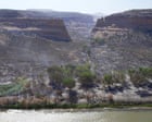
Where the jet stream dips deeply southward over the Pacific Northwest, it creates a trough. This trough acts as an atmospheric conveyor belt, pulling freezing marine air straight out of the Gulf of Alaska and dumping it over inland states like Idaho, Montana, and Wyoming. This explains why the regional snow line, which normally sits comfortably at around 3,300 meters during the summer months, dropped to a staggering 1,800 meters over the weekend. High-altitude mountain passes are seeing accumulating snow at a time when local tourist economies rely heavily on clear, accessible roads.
Conversely, directly downwind of this deep trough, the jet stream loops violently northward over the Midwest and the East Coast. This creates a massive ridge, commonly referred to as a heat dome. This ridge acts as a high-pressure lid. It traps the heat radiating from the ground, compresses it, and prevents clouds or cooler air from entering the region to break the cycle.
The physical mechanics here are relentless. As high pressure settles over the Mid-Atlantic and New England, the air sinks. Sinking air warms by compression, a process that dries out the atmosphere and maximizes the amount of solar radiation reaching the surface. This is the exact dynamic that is expected to send temperatures soaring toward 40 degrees Celsius in New York, Philadelphia, and Washington DC in the days leading up to the Fourth of July weekend. Nighttime temperatures will offer little relief, struggling to drop below the high 20s. For cities built primarily of concrete and asphalt, this lack of nocturnal cooling is particularly hazardous.
The Wildfire Paradox in the West
One might assume that an influx of cold air and unseasonal precipitation would provide a welcome reprieve for a drought-stricken West. The reality on the ground is far more complicated and far more dangerous. The leading edge of this cold front has actually intensified the threat of catastrophic wildfires across Utah, Colorado, and Arizona.
This phenomenon is known to foresters and meteorologists as a dry frontal passage. As the cooler air mass collided with the hot, dry air already sitting over the Southwest, it generated massive instability in the lower atmosphere. Instead of producing steady, soaking rainfall, the system created widespread dry lightning strikes. These bolts of electricity struck parched vegetation across millions of acres of vulnerable public land, igniting a flurry of new blazes in ecosystems that are already critically stressed.
Furthermore, the pressure difference between the incoming cold air and the departing heat created intense, sustained winds. Gusts exceeding 50 miles per hour have been clocked across the Great Basin. These winds act as an atmospheric bellows, driving oxygen into fresh ignition points and pushing existing fires through parched timber and brush at terrifying speeds. The 2026 fire season is already tracking well ahead of historical averages. This sudden burst of wind and lightning has effectively undone any minor moisture benefits the cold front brought to the high valleys.
Local fire crews are facing unprecedented tactical challenges. They are forced to shift from fighting fires in blistering triple-digit heat to managing containment lines in near-freezing temperatures and driving sleet, all within a forty-eight-hour window. The logistical strain of re-equipping personnel for completely different survival scenarios in the middle of an active fire zone is immense.
The Concrete Jungle Heat Dome
As the Western mountains reckon with ice and wind, the major population centers of the East Coast are facing a quiet crisis of thermal accumulation. The human body requires a period of cooling at night to shed the heat accumulated during the day. When urban centers fail to cool down after sunset, the cumulative biological stress increases exponentially.
The built environment of modern cities worsens this effect. Bricks, asphalt, and concrete absorb vast amounts of solar energy during the day and slowly radiate that heat back into the immediate environment long after dark. This creates an artificial microclimate where urban temperatures can remain up to ten degrees higher than surrounding rural areas.
Air conditioning systems offer a mechanical shield, but they also contribute to the underlying problem. Every unit operating in a major city pulls heat out of an interior space and dumps it directly onto the street, further raising the external ambient temperature. This creates a feedback loop that places immense strain on regional electrical grids.
Power distributors along the PJM Interconnection and the New York Independent System Operator are already watching their load forecasting models with growing concern. The problem is not just the peak demand during the middle of the afternoon. The true danger lies in the sustained base load required to keep millions of compressors running through consecutive nights when the outside air never drops below 28 degrees Celsius.
Transformers require time to cool down to operate efficiently. When they are subjected to uninterrupted high demand in hot environments, their internal insulation degrades rapidly, leading to localized equipment failures and cascading blackouts. If a major grid failure occurs during the height of this heatwave, the public health consequences will be severe.
A Fragmented Grid for a Fragmented Climate
The current weather setup highlights a fundamental flaw in the design of the national energy infrastructure. The United States power grid is largely divided into distinct, isolated regional networks that have a limited capacity to share large volumes of electricity across long distances.
When the West has an excess of wind energy generated by the intense pressure gradients of a cold front, that power cannot easily be transmitted to the East Coast to help satisfy the massive electricity demand caused by a regional heat dome. The transmission lines simply do not exist in the quantity or capacity required to balance the continental energy load.
This lack of structural flexibility means that each region must absorb the full impact of its respective climate emergency using only its localized assets. If the East Coast runs short of generating capacity this week, it cannot look to the roaring winds of Wyoming or Montana for emergency support. The energy is stranded on the wrong side of the continental divide.
+------------------+----------------------------------+----------------------------------+
| Region           | Current Weather Anomaly          | Primary Structural Risk          |
+------------------+----------------------------------+----------------------------------+
| Pacific NW &     | Low-elevation summer snow,       | Logistics, sudden shift in fire  |
| Rockies          | temperatures 10C below average   | behavior due to dry lightning    |
+------------------+----------------------------------+----------------------------------+
| Midwest &        | Extreme heat dome, forecast      | Grid strain, lack of nocturnal   |
| East Coast       | highs approaching 40C            | transformer cooling              |
+------------------+----------------------------------+----------------------------------+
The data from recent summers suggests that these atmospheric blockages are becoming more frequent. When the jet stream loses its momentum, it tends to get stuck in place for weeks at a time, extending the duration of both localized freezes and prolonged heatwaves. This stability is deadly. It turns a brief period of unusual weather into a prolonged test of endurance for infrastructure that was designed for a far more predictable world.
Municipalities are trying to adapt by setting up public cooling centers and adjusting working hours for outdoor laborers, but these are temporary patches on a systemic issue. The physical layout of our societies assumes a level of climate stability that no longer matches the reality of the skies above us.
Emergency management agencies are now forced to operate on multiple fronts simultaneously, tracking winter weather warnings in the Rocky Mountains while deploying extreme heat response teams in the urban corridors of the Northeast. The resources required to handle these simultaneous, diametrically opposed disasters are stretching federal and state budgets to their breaking points. The old playbook of seasonal preparedness is rapidly becoming obsolete.
The immediate focus remains on survival. For residents in the East, that means minimizing outdoor exposure and monitoring vulnerable neighbors. For those in the West, it means watching the horizon for lightning-sparked fires while navigating unseasonal mountain snow. The atmosphere has fractured, and the true cost of that division is about to be tallied in megawatts and human lives.