Metro Vancouver operates as a high-stakes hydraulic laboratory where the convergence of steep topography, aging municipal assets, and intensifying Pacific moisture corridors creates a recurring failure state for urban drainage systems. The immediate operational challenge is not merely "preparing for rain" but managing a complex interplay of soil saturation thresholds, gravity-fed outflow limitations, and the synchronized deployment of multi-jurisdictional crews. When a region is already water-logged, the margin for error in infrastructure performance vanishes. The ability to mitigate the next surge depends entirely on the mechanical readiness of pumping stations and the manual clearance of "catch basin bottlenecks" before the peak hydrograph arrives.
The Physics of Saturated Failure
The primary constraint facing Metro Vancouver during back-to-back storm events is the loss of soil storage capacity. In a dry state, the region’s landscape acts as a buffer, absorbing initial precipitation through infiltration. However, once the ground reaches a state of total saturation, the runoff coefficient shifts toward 1.0. This means nearly every drop of subsequent rainfall becomes surface runoff, instantly entering the engineered drainage network rather than being filtered through the earth.
This shift transforms a manageable weather event into a critical infrastructure stress test. The drainage systems—many designed decades ago based on historical precipitation averages—are forced to handle volumes that exceed their hydraulic design capacity. This leads to surcharging, where water pressure within the pipes exceeds the pipe's internal diameter, causing manholes to blow and basements to flood via backflow.
Three Pillars of Municipal Response Strategy
To counter these physical realities, municipal engineering departments deploy a three-stage operational framework focused on maximizing the efficiency of existing hardware.
1. Pre-Emptive Hydraulic Capacity Recovery
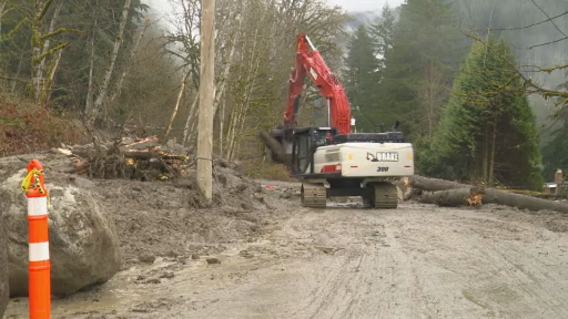
Before the first raindrop falls, crews focus on "daylighting" the system. This involves the manual removal of organic debris and anthropogenic litter from catch basin grates. A single blocked grate can create a localized flood zone even if the underground pipe is empty. Logic dictates that the system is only as functional as its intake points. Strategic deployment prioritizes high-risk "sump" areas—low-lying topographic points where water naturally pools.
2. Mechanical Redundancy and Pump Station Optimization
In low-lying areas like Richmond, Delta, and parts of Surrey, gravity is insufficient to move water out to the Salish Sea or the Fraser River. These zones rely on mechanical lift.
- Pump Capacity: Ensuring all turbines are free of debris.
- Power Backup: Testing diesel generators to ensure that a localized grid failure does not lead to a catastrophic drainage failure.
- Trash Rack Maintenance: Clearing the screens that protect pump impellers from large debris like logs or shopping carts, which can cause mechanical seizure during peak flows.
3. Real-Time Flow Management and Diversion
Large-scale infrastructure like the Cleveland Dam or the various detention ponds throughout the Lower Mainland acts as a shock absorber. By modulating the release of water from these reservoirs, engineers can "shave the peak" of the flood hydrograph, ensuring that the surge from the mountains does not hit the urban core at the exact moment of high tide.
The Cost Function of Deferred Maintenance
The vulnerability of Metro Vancouver is compounded by an "infrastructure gap"—the difference between the current state of assets and the requirements for modern climate resilience. The cost of maintaining these systems follows a non-linear curve. Routine cleaning of a culvert is a low-cost operational expense. However, if that culvert fails during a storm, the resulting emergency repair, property damage claims, and environmental remediation costs can be 10 to 50 times higher than the original maintenance cost.
Municipalities are forced to balance limited tax-base budgets against the looming threat of "once-in-a-century" storms that now occur every decade. This necessitates a shift from reactive maintenance to predictive modeling. Using real-time sensors in sewers and watercourses, crews can now identify which sections of the city are reaching critical capacity before the water breaks the surface.
Topographic and Tidal Bottlenecks
Geography dictates the severity of the risk. Metro Vancouver is defined by a "double-squeeze" effect:
- The Mountain Effect: Steep slopes in the North Shore and Coquitlam accelerate runoff, leading to high-velocity flows that carry heavy debris loads. This debris acts as a "clogging agent" for downstream infrastructure.
- The Tidal Lock: During high tide, especially "King Tides," gravity-fed storm outfalls are submerged. If the sea level is higher than the water level in the storm pipes, the water cannot exit. This creates a backup that extends kilometers inland.
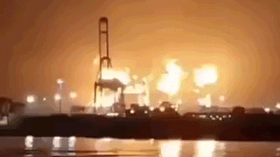
The synchronization of a peak atmospheric river with a high tide represents the "Worst Case Scenario" for the region. In these instances, no amount of crew preparation can overcome the physical reality that the water has nowhere to go. The strategy then shifts from drainage to containment and life-safety.
Strategic Allocation of Human Capital
The human element of storm response is governed by exhaustion and logistics. Crews in Vancouver, Burnaby, and Surrey operate on 12-hour rotating shifts during these events. The primary constraint is not just the number of trucks, but the number of qualified personnel able to operate heavy machinery in high-wind, low-visibility conditions.
The logistics of "sandbagging" illustrate this labor intensity. While a machine can fill bags quickly, the placement of those bags to create an effective hydrostatic barrier requires precise manual labor. A failure to overlap bags correctly or to account for "piping" (water flowing underneath the barrier) renders the entire effort useless.
The Inevitability of Hydro-Climatic Shift
The current "water-logged" state of the region is a symptom of a broader shift in the Pacific Northwest’s hydrological cycle. Historical data is becoming an unreliable guide for future risk. The "return period" for extreme rainfall is shrinking.
Infrastructure that was built to handle a 1-in-50-year storm is now being tested by 1-in-10-year events. This creates a state of perpetual "infrastructure fatigue," where the system never fully recovers before the next stressor arrives. The result is a cumulative weakening of embankments, a gradual silting of pipes, and a weary workforce.
Operational Recommendations for Regional Resilience
The transition from a defensive posture to a resilient one requires a decoupling of municipal response from "reactive" cycles.
- Hardening Critical Nodes: High-capacity pump stations must be upgraded with smart-grid integrations to ensure power continuity.
- Expansion of Permeable Surfaces: Urban planning must mandate "green infrastructure" (bioswales and permeable pavement) to reduce the runoff coefficient in densifying neighborhoods.
- Regional Data Integration: Flood risks do not respect municipal boundaries. A unified, real-time "Hydraulic Command Center" for the entire Metro Vancouver region would allow for better coordination of upstream reservoir releases with downstream capacity.
The current strategy of clearing catch basins and staging pumps is a necessary tactical response, but it is a temporary fix for a structural problem. As the next drenching approaches, the primary objective is to maintain the integrity of the "trunk" system—the large-diameter pipes and major pump stations—while accepting that localized surface flooding is an unavoidable consequence of the region’s current geographic and engineered state. The focus remains on preventing the "Systemic Collapse" where primary infrastructure fails, leading to prolonged recovery times and multi-billion dollar losses.
The final strategic move for the current storm cycle is the deployment of "Mobile Pumping Assets" to the Port Coquitlam and Pitt Meadows corridors. These areas represent the highest risk for dike overtopping due to the confluence of the Fraser and Pitt Rivers. By pre-positioning high-volume submersible pumps now, the region can provide an artificial "pressure relief valve" for when the natural drainage reaches its physical limit later this week.