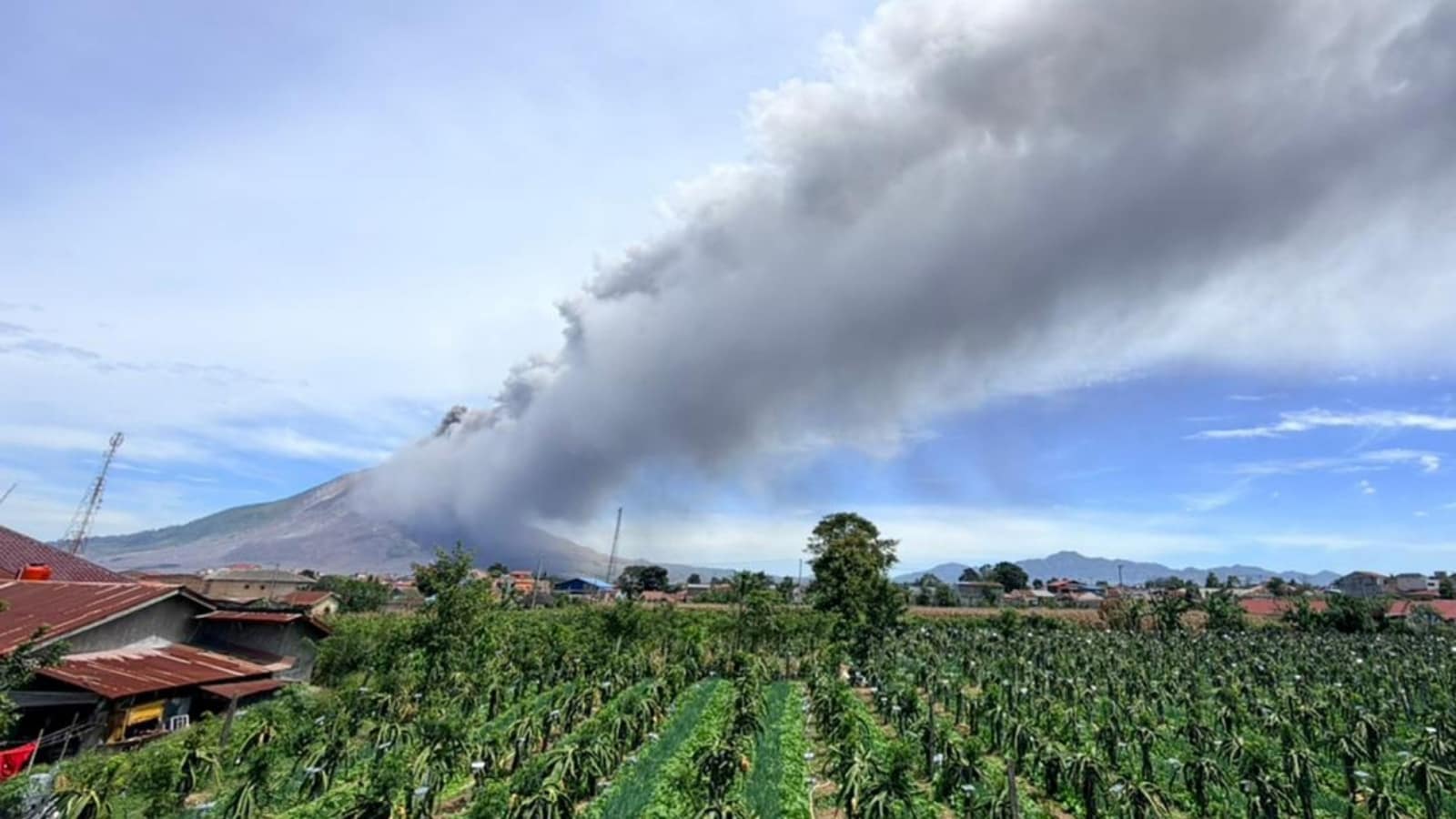
Mount Sinabung woke up again. When the volcano in North Sumatra erupted, it shot a thick column of black ash roughly 3,500 meters into the sky. If you track volcanic activity in Indonesia, you know this mountain rarely stays quiet for long.
The eruption happened at 10:17 a.m. local time, lasting for just over an hour. Seismic equipment recorded a maximum amplitude of 120 millimeters. Winds carried the dense ash cloud east and southeast, blanketing nearby communities and tourist spots like Berastagi in grey dust. Learn more on a related topic: this related article.
The Reality of Living on the Ring of Fire
Indonesia sits squarely on the Pacific Ring of Fire. Everyone talks about it, but the daily reality for locals is entirely different. Mount Sinabung itself spent centuries completely dormant, lulling generations into a false sense of security before violently roaring back to life in 2010.
Since then, it has kept scientists on edge. Deadlier blasts in 2014 and 2016 claimed multiple lives, proving that historical dormancy means nothing to an active magma chamber. When a mountain has an active history like this, a 3,500-meter ash column isn't just a scenic photography moment. It's a severe hazard indicator. Further journalism by Reuters delves into comparable views on this issue.
Why Authorities Immediately Raised the Alert
Following the blast, the Center for Volcanology and Geological Hazard Mitigation (PVMBG) bumped the alert status up to Level III. That is serious business.
Local agencies and disaster teams moved quickly to manage the ground situation. Officials closed off access around Lau Kawar Lake and cleared out nearby camping zones like Kuta Gugung village. They enforced strict exclusion zones:
- No human activity within a 3-kilometer radius of the main summit.
- Expanded restrictions reaching up to 4.5 and 6 kilometers along the south-southeast sectors where pyroclastic flows and ash drift pose the highest immediate threats.
Volcano safety rules often get ignored by tourists looking for a dramatic view. Officials had to reiterate that staying near these exclusion zones is a gamble with very low odds of winning.
The Danger Beyond the Ash Cloud
An ash plume gets all the media attention, but locals know the real secondary threat comes when it rains. Volcanic ash mixes with water on the slopes to create fast-moving mudflows called lahars.
These heavy slurries of rock, mud, and debris can scour river valleys clean and destroy bridges without much warning. Communities living along rivers originating from Sinabung's peak are currently on high alert for these cold lava floods, especially since rainy seasons in Sumatra can turn a dry riverbed into a roaring hazard within minutes.
Authorities continue to distribute protective face masks and monitor seismic data via applications like MAGMA Indonesia. If you're planning travel to the Karo plateau or North Sumatra, check official updates from the geological agency before heading anywhere near the slopes. Keep your distance, heed the exclusion zones, and respect the mountain.