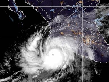
Every time a storm like Simon churns toward land, the media machine spins up its favorite panic metric. We get breathless updates about winds ticking up, barometric pressure dropping, and the almighty Saffir-Simpson scale ticking from a Category 3 to a Category 4. Meteorologists look grave on television. Payout algorithms feast on the terror. And the public prepares for an entirely wrong disaster.
Stop looking at the category. It is lying to you. Discover more on a connected issue: this related article.
The lazy consensus in disaster reporting is that a higher number means a worse storm across the board. If Simon hits Mexico's coast as a Category 4, the public mind envisions flattened concrete and flying cars, while civil defense prepares for wind damage. But the Saffir-Simpson scale measures exactly one thing and one thing only: sustained wind speed. It knows nothing about water. It knows nothing about forward speed. It knows nothing about geography, topography, or the sheer volume of liquid sky about to be dumped onto vulnerable terrain.
I have spent decades watching disaster response systems react to the number on the advisory rather than the reality on the ground. Communities breathe a sigh of relief when a storm downgrades from a Category 4 to a Category 3 just before landfall, as if a Category 3 is a gentle summer breeze. Then the storm stalls, drops thirty inches of rain on a mountain range, triggers catastrophic mudslides that wipe entire villages off the map, and leaves pundits wondering how such a "weakened" storm caused so much carnage. Additional journalism by USA Today highlights related views on the subject.
The category system is a relic. It is time to dismantle it.
The Fatal Flaw in Wind-Obsessed Metrics
Let us look at the mechanics of what makes tropical cyclones lethal. Historically, wind accounts for a fraction of hurricane fatalities. The vast majority of deaths—roughly ninety percent in many modern storms—come from water. Storm surge pushes massive walls of the ocean inland. Inland freshwater flooding drowns cars, houses, and people miles from the coast.
Yet the entire psychic weight of hurricane preparation rests on a scale designed in the early 1970s by Herbert Saffir, a structural engineer, and Bob Simpson, director of the National Hurricane Center. Their goal was simple: estimate potential structural damage to buildings based on wind speed. That is it. It was never meant to be a general danger index for human life.
When Simon approaches land as a Category 4, wind speeds are terrifying. Sustained winds over 130 miles per hour will rip roofs off poorly constructed buildings and snap power lines like dry twigs. But a fast-moving Category 4 that brushes a coast quickly might drop minimal rain and generate manageable surge. Conversely, a crawl-speed Category 1 can sit over a coastal plain for three days and drown a province.
By hyper-focusing on wind category, we prime the public for the wrong fight. People board up windows, secure patio furniture, and stock up on generators while ignoring the fact that their house sits in a flash-flood zone fifty miles inland. The wind blows, they survive the gusts, and then the creeks rise while they are congratulating themselves on weathering the storm.
Why Fast-Moving Hurricanes Are More Dangerous Than You Think
Consider the forward speed of the system. A hurricane is not just a spinning top; it is a massive thermodynamic engine moving across a surface.
When a storm moves fast, it limits the duration of extreme winds in any one spot, but it also changes how storm surge behaves, often catching coastal barriers off guard with rapid water accumulation. When a storm stalls, however, the math shifts to pure horror. A stalled Category 4 dumps exponential amounts of rain compared to a fast-moving one because the atmosphere has time to continually ingest moisture from warm ocean water and dump it over the exact same river basins.
If Simon crawls at two miles per hour upon landfall, the wind category becomes a secondary footnote. The primary story is precipitation efficiency. Meteorologists understand this nuance completely. They write complex forecast discussions about it. But the moment that data hits the public broadcast cycle, it gets flattened into a single digit: Category 4.
That flattening kills people. It replaces critical thinking with a blunt instrument of fear.
The Psychology of the Warning System
We live in a culture addicted to grading systems. We want letter grades, numerical scores, and color-coded alerts that tell us instantly how scared we need to be. The Saffir-Simpson scale satisfies that cognitive laziness. It gives news anchors a clean narrative arc: the storm is intensifying, the number is going up, run for your lives.
Imagine a scenario where emergency management scrapped the wind-speed category entirely and replaced it with a multi-factor impact matrix before every single storm. Imagine public alerts reading: "This is a low-wind, catastrophic-flood event" or "This is a localized wind disaster with minimal rain impact."
People would hate it at first. It requires cognitive effort. It forces individuals to assess their specific geography relative to the specific threat profile of the incoming system. But it would force a profound shift in preparation. Homeowners in low-lying river valleys would stop worrying about plywood for their windows and start worrying about sandbags and evacuation routes. Coastal high-rise residents would understand that wind shear at the twentieth floor is a very different problem than storm surge at sea level.
Instead, we stick with a monolithic number that tells a high-rise dweller in a concrete fortress and a floodplain resident in a mobile home the exact same thing: Category 4. That is not communication. That is a lottery.
Dismantling the Hype Machine
The media loves a Category 4 or Category 5 designation because it justifies the 24-hour coverage loop. Weather channel hosts stand outside in waterproof gear, leaning dramatically into 40-mile-per-hour gusts while pretending they are fighting for their lives against a Category 4 monster, long before the core of the storm has even arrived. It is theatrical catastrophe porn.
Meanwhile, the real danger is happening quietly in watersheds two counties over, where soils are already saturated and small creeks are turning into raging torrents.
If you live in the path of Simon, or any future storm carrying these terrifying numerical designations, you need to strip away the broadcast hype. Look past the wind scale. Ask three questions that actually matter:
- What is the forward speed of this system, and how long will it sit over my region?
- What is the local topography, and am I vulnerable to inland freshwater flooding or storm surge?
- Where is the heaviest rain axis projected to fall relative to my exact coordinates?
Until emergency communication evolves past a simplistic wind-speed scale, you are on your own to figure out the real threat. Do not let a number dictate your survival strategy. The storm does not care what category it is. Neither should you.