Seasonal outlooks sell clicks. Nuance does not.
Every autumn, climate headlines roll off the assembly line with the same tidy summary: a wetter winter here, a warmer winter there, maybe a surprise snow band across the southern states. Readers skim the map, nod along, and treat the forecast like a grocery list. Cold on the left. Wet on the right. Snow where nobody owns a shovel.
That framing is lazy. Worse, it is expensive.
A winter can be warmer than average on paper and still punish you with brutal freezes, ice storms, and whiplash thaws. A winter can be wetter than average and still leave reservoirs under-recharged because the rain fell on frozen ground, evaporated fast, or came as one violent deluge instead of steady snowpack. And southern snow rarely delivers the calm winter wonderland people picture when they read a headline about snow in the south. It delivers downed power lines, grid stress, fender benders, and municipalities caught without road salt.
I have watched municipalities, logistics operators, and property managers blow serious money treating seasonal outlooks as if they were guarantees. A city public works director sees a "warmer winter" headline and trims salt reserves or delays fleet prep. Then a single moisture-rich storm rides a cold air mass south, turns highways into skating rinks, and costs ten times what quiet preparation would have cost. Or a utility company budgets around mild temperatures, only to get hit by a sharp Arctic plunge that spikes peak heating demand while freezing equipment that rarely sees sub-freezing stress.
The lazy consensus assumes weather behaves like a thermostat and a rain gauge averaged over ninety days. Real winter risk lives in the swings, the phase changes between rain, sleet, and snow, and the mismatch between what infrastructure was built for and what actually hits it.
The Myth of "Warmer and Wetter"
Forecasters use seasonal outlooks to show probabilities—whether a three-month window tilts above or below historical averages for temperature and precipitation. That is useful statistical context if you understand its limits. Most people do not. They read "warmer" and picture mild afternoons. They read "wetter" and picture gentle rain.
Atmospheric physics does not care about neat averages. A winter season is a sequence of distinct air masses, jet stream waves, and storm tracks. You can average a 15-degree cold snap with a string of 55-degree days and call the stretch "warmer than normal" over a long enough window. That math hides the exact days that burst pipes, strain electrical grids, or kill winter crops that broke dormancy early.
Precipitation has the same trap. "Wetter" tells you total moisture volume is favored to run high, not how that moisture arrives or what it lands on. Fifty millimeters of steady, soaking rain over two weeks behaves nothing like fifty millimeters dumped in six hours on saturated soil. In cold regions, rain on snowpack triggers rapid runoff and flooding. In warmer regions, heavy rain increases flash-flood risk and erosion while doing less to build slow-release spring water supplies than mountain snowpack does.
Meteorologists at institutions like the NOAA Climate Prediction Center and academic researchers studying teleconnections—large-scale climate patterns such as El Niño, La Niña, the Madden-Julian Oscillation, and stratospheric polar vortex shifts—have spent decades explaining why seasonal signals are probabilistic rather than deterministic. Even strong ocean signals do not lock the atmosphere into a single script. Mid-latitude weather is noisy. Blocking highs, sudden stratospheric warmings, and storm-track shifts regularly override broad seasonal tendencies for weeks at a time.
When an outlet reduces that complex probability space to "wetter and warmer," it strips away the very uncertainty that makes winter planning hard.
Why Snow in the South Is a Stress Test, Not a Novelty
Mention snow in the south and half the internet reaches for jokes about milk and bread. That reaction misses how southern winter storms actually work.
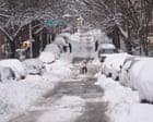
Southern snow often happens when Gulf or Atlantic moisture meets a shallow layer of cold air pushed south by high pressure. Because temperatures hover right around freezing—often a razor-thin margin between 30°F and 35°F—these events rarely stay clean, dry powder. They frequently shift between heavy, wet snow, sleet, and freezing rain.
Wet snow is heavy. A few inches of dense, water-logged snow carries far more weight on tree limbs and power lines than light, fluffy snow in the northern plains. Freezing rain is worse. Even a quarter-inch to half-inch of ice accretion can snap branches, bring down distribution lines, and shut down roads that lack thick snow cover to give tires traction.
Infrastructure exposure makes the difference. Northern states have fleets of plows, brine systems, heated barns, and drivers trained for winter conditions. Southern cities allocate tax dollars toward hurricanes, summer heatwaves, severe convective storms, and fast-growing suburbs—not dozens of snowplows that sit idle for years. When a major winter storm hits a southern metro area, the bottleneck is rarely meteorological mystery. It is exposed overhead lines, hilly terrain, shaded overpasses, and a lack of heavy clearing equipment.
Calling southern snow a fun headline detail obscures a real operational hazard. A southern winter storm is a low-frequency, high-friction event. Low frequency makes budgets tight. High friction makes recovery slow.
The Questions People Keep Asking Wrong
Search behavior around seasonal weather tends to chase trivia instead of decisions. People type questions looking for a clean yes-or-no verdict, when the better move is changing how they read risk.
"Will it snow a lot this winter?"
Wrong question. Snowfall totals depend on two ingredients lining up at the same time: enough moisture and cold enough air through the column of the atmosphere. A region can be wetter and still see less snow if temperatures sit just above freezing during most storms. Conversely, a region can be drier overall and still get hammered by one or two well-timed nor'easters or clipper systems.
Ask instead: How sensitive are my plans to marginal temperatures right around freezing, and how fast can I adjust if rain turns to ice or wet snow?
"Should I plan for a mild winter if the forecast leans warm?"
Brutally honest answer: no. A lean toward warmer-than-average temperatures lowers the odds of prolonged, relentless cold across the full season, but it does not cancel severe cold outbreaks. High-latitude blocking or a disrupted polar vortex can still send sharp cold waves deep into the country.
In fact, "warm" winters can carry their own hidden tax. Less persistent snow cover removes natural ground insulation in some areas, allowing frost to penetrate deeper into soil during cold snaps. Mild stretches followed by sudden freezes also stress pavement, plumbing, and landscaping more than steady cold does.
"Does a wetter winter mean drought is over?"
Not automatically. Drought recovery depends on starting soil moisture, groundwater levels, reservoir storage, and timing. If soils are baked dry or compacted, heavy rain runs off into creeks and rivers rather than soaking in. In western watersheds, snowpack matters enormously because snow acts as a natural reservoir that melts gradually into spring and summer. Rain earlier in the season does not always replace lost high-elevation snowpack.
What Actually Works When Forecasts Lean Wet and Warm
If you manage money, property, travel, or operations, stop treating seasonal forecasts like schedules and start treating them like risk alerts.
- Budget for volatility, not the seasonal mean. Build contingency buffers around high-impact edge cases—ice accumulation, rapid freeze-thaw cycles, and heavy single-storm rainfall—rather than assuming every day will match the three-month average.
- Audit your weak links before the first cold front. Check drainage grates, gutters, sump pumps, exposed pipes, roof loads, and backup power before storms arrive. Preventive maintenance costs a fraction of emergency dispatch.
- Separate moisture volume from temperature margin. If a region leans wet and near-freezing, treat sleet, freezing rain, and slushy road conditions as primary hazards rather than assuming harmless rain.
- Keep plans flexible instead of rigid. For travel, shipping, and outdoor work, build buffer windows around major storm systems and watch short-range models (3 to 7 days out) for actual execution, not seasonal maps made months ahead.
There is a real downside to this approach. Planning for extremes and swings can feel paranoid when a mild stretch rolls through and nothing breaks. Extra prep takes time, attention, and sometimes modest upfront spend that looks unnecessary in hindsight when the weather stays calm.
That is the trade-off of real risk management. You do not prepare for the average winter. You prepare for the week the average fails.
Ignore the cozy summary on the weather map. Watch the freezing line, clear the drains, and keep your margin intact.