Putting an AI unit inside a crisis bunker sounds smart on a press release. Yet algorithms don't haul water up a steep moorland ridge when a heatwave turns heather into tinder.
Following Britain's scorching summer of 2026, Prime Minister Andy Burnham unveiled plans at England's first wildfire resilience summit at Aintree in Liverpool for a dedicated wildfire AI unit housed inside the National Situation Centre within the Cobra emergency rooms. The goal is simple enough: spot outbreaks earlier and speed up response times using satellite feeds, early warning models, and input from partners such as Google, Airbus, and VodafoneThree. At the same time, Downing Street announced up to £45 million for specialist wildfire protective gear and teams, £25 million to rewet dried-out English peatlands as natural firebreaks, and plans to fit RAF Chinook helicopters and A400M transport aircraft for aerial firefighting for the first time.
Anyone who has watched wildfire policy up close knows the catch. Early detection only helps if crews on the ground have water pressure, lighter PPE that doesn't cook them in heatwaves, and clear command lines before flames jump a ridge. Let's look honestly at what Burnham's wildfire AI unit actually does, where the real bottlenecks sit, and what needs to happen next so this isn't just another headline after a brutal summer.
What the Wildfire AI Unit Actually Aims to Do
Satellites and sensors already pick up heat anomalies around the globe, yet turning raw telemetry into a fast, accurate alert for a local fire control room is messy work. Greece uses AI-backed satellite tools to track fire risk and spot ignitions, and ministers want a similar edge inside Cobra's National Situation Centre so national decision-makers aren't piecing together fragmented reports mid-crisis.
In practice, a national AI unit can pull together several streams at once:
- Satellite and thermal tracking: Flagging smoke plumes and hot spots in remote moorland or forest edges before passing walkers call 999.
- Weather and fuel modeling: Combining Met Office heat and drought data with dry vegetation maps to show where a spark could explode fastest.
- Comms and early warnings: Working with telecoms and tech partners like VodafoneThree, Airbus, and Google to speed up alerts and coordinate across agencies.
That sounds tidy in theory. In reality, false alarms from agricultural burning, industrial heat, or cloud cover can waste precious minutes if models aren't tuned to British terrain. Having AI sit inside Cobra helps central coordination, though local fire and rescue services still run the incident on the ground.
Why 2026 Forced a Reckoning on UK Wildfires
Britain used to treat big landscape fires as a rare nuisance rather than a core national security risk. Summer 2026 shattered that illusion.
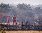
Fire services in England and Wales responded to 1,132 wildfires in the year up to August 16, already beating the full-year total from the previous year. Blazes tore through places far apart—from Stourbridge and grassfires threatening homes in the West Midlands to a major incident near Suffolk's Sizewell B nuclear power station and a protected nature reserve, plus serious fires in Scotland's Cairngorms, Wales's Rhinogydd mountains, and Northern Ireland's Mourne Mountains. Meanwhile, the Met Office found that climate change made the extreme heat roughly 130 times more likely, and July 2026 stood out as a record-bad month for wildfires in England.
When over half of surveyed fire services lack dedicated wildfire PPE, tech alone won't keep firefighters safe on a burning hillside.
Criticism hit Burnham from two directions at once around the summit. Campaigners and opposition MPs pointed out that earlier countryside wildfire preparedness plans under the Conservatives had been quietly dropped, raising fair questions about why basic groundwork lagged behind. At the same time, unions and climate critics argued that bolting AI and military aircraft onto emergency response falls short if wider fossil-fuel and climate policy sends mixed signals. Both points deserve straight talk: you can't treat symptoms with software while ignoring fuel loads on the land or long-term emissions.
Gear, Peatlands, and Aircraft Matter More Than Hype
If you ask frontline firefighters what saves time and lives during a moorland blaze, they rarely start with a neural network. They talk about water, breathing protection, heat stress, and access.
Standard structural firefighting kit was built for house fires, not hours hiking up rough slopes under a blazing sun. Heavy gear traps body heat, pushing crews toward exhaustion or tempting them to strip layers off in hazardous smoke, while basic dust masks don't block carbon monoxide. That is why the up to £45 million package for lighter wildfire PPE and specialist teams is so practical—provided the money reaches cash-strapped services quickly and isn't eaten up by slow procurement.
Land management is just as critical. Drained, dry peatlands burn deeply and stubbornly, releasing stored carbon and choking nearby towns with smoke. Putting £25 million into restoring English peatlands from April 2027 to April 2029—alongside support for farmers to fireproof land and better Met Office forecasting—tackles the sponge effect that slows fire spread. And fitting RAF Chinook helicopters and A400M aircraft for aerial firefighting gives commanders heavy-lift options on steep or remote ground where fire engines can't roll.
| Measure in the 2026 Package | What It Tries to Solve | Main Practical Catch |
|---|---|---|
| Wildfire AI unit in Cobra | Faster spotting and national situational awareness | Needs clean local data and clear handoffs to local brigades |
| Up to £45m for PPE and teams | Heat exhaustion, carbon monoxide risk, and kit gaps | Rollout speed and training across dozens of services |
| £25m for peatland restoration | Dried-out bogs acting as fuel rather than water stores | Multi-year timeline running from 2027 to 2029 |
| RAF Chinooks and A400Ms | Reaching steep hillsides and remote moorland | Water sourcing, air tasking rules, and rapid call-out |
One detail from the summer coverage that often gets glossed over is water supply itself. Firefighters have repeatedly raised alarms about weak hydrants and scarce open water near rural blazes. Even the best helicopter bucket needs a reliable refill point nearby to keep cycle times short.
Where Plans Can Still Go Wrong
Honestly, the biggest risk with any post-disaster AI announcement is treating the dashboard as the solution. A crisp map inside Whitehall doesn't automatically mean a rural station has an extra off-road vehicle, trained wildfire spotters, or an agreed water-drop plan with local landowners.
There are three friction points to watch closely over the next year:
- Cross-border coordination: Wildfires don't stop at county or nation lines, so England's action plan has to mesh cleanly with Scotland, Wales, and Northern Ireland.
- Public behavior during heatwaves: Disposable barbecues, campfires, and discarded glass still spark plenty of fires; temporary bans like Burnham's August move on disposable barbecue sales help only if paired with clear local messaging and enforcement.
- Honest limits of AI: Models can estimate risk and flag anomalies, yet ground truth still comes from human eyes, thermal cameras, and local terrain knowledge.
Practical Next Steps to Watch and Act On
If you follow UK resilience policy, run local emergency planning, or live near moorland, heathland, or woodland, you don't have to wait for next summer to see whether this plan has teeth.
- Track the operational details: Watch for concrete timelines on how fire services request RAF Chinook or A400M support, how the £45 million PPE fund is split, and how the £25 million peatland grant scheme rolls out from April 2027.
- Check local high-risk spots: If you own land or manage estates near dry heather, gorse, or peat, map out water access points, vehicle tracks, and natural firebreaks before spring drying sets in.
- Follow seasonal fire alerts: Pay attention to Met Office heat and wildfire warnings when dry spells hit, skip open flames or disposable barbecues on dry grass and moorland, and call 999 right away with a clear location if you spot smoke where there shouldn't be any.
A wildfire AI unit inside Cobra can sharpen the picture at the top, yet real resilience is built in the soil, the water supplies, and the kit carried by the people closest to the flames.