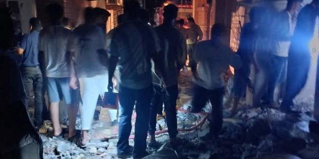
Heavy machinery finally rolled into the core disaster zone around Gyirong Port after engineering crews punched through the wreckage of the G216 national highway. A catastrophic glacier collapse on August 26 triggered a violent cascade of mudslides and floods across the China-Nepal border, wiping out residential sectors and isolating hundreds of individuals. For a full week, the only land route leading to the critical border crossing lay in ruins, forcing authorities to rely entirely on emergency airdrops and foot patrols through treacherous ravines. Now that ground access is restored, more than two thousand personnel are intensifying search operations for the 546 people still missing on the Tibetan side, while cross-border tallies in Nepal continue to climb into tragic territory.
Yet the reopening of a single mountain highway tells only part of a much larger story about ecological vulnerability along High Asia's fractured geography.
The Anatomy of a High-Altitude Catastrophe
Disasters of this magnitude rarely happen in isolation. When an ice mass gives way at high altitudes, the physics involved are brutal and immediate. Millions of cubic meters of solid ice, mixed with loose moraine and rock, transform into a liquid slurry upon impact. Gravity does the rest, funneling slurry down narrow gorges at speeds that overwhelm any natural or man-made drainage system.
At Gyirong, the geographical squeeze compounded the devastation. Squeezed between towering, unstable cliffs and a raging river, the local border inspection complex and surrounding settlements were buried under meters of dense mud and stone.
Engineering teams faced an impossible bottleneck. Before excavators and life-detection units could touch the ground, crews had to stabilize sheer rock faces while dodging persistent rain and monitoring upstream barrier lakes. These natural dams form when debris blocks flowing rivers, creating secondary ticking clocks for disaster response teams downstream. While those specific secondary risks have receded, the threat of recurring landslides remains an hourly hazard for anyone working in the ravine.
Logistics in Extreme Terrains
Moving heavy equipment into a Himalayan gorge is an exercise in logistical endurance. The region depends on delicate transport arteries carved into steep mountain contours. When those arteries snap, the modern state's technological muscle is temporarily neutralized.
For seven days, the missing—including foreign nationals from dozens of countries—depended on an air bridge of supplies and the physical stamina of soldiers equipped with search dogs and acoustic detectors.
State-led deployment was massive. Over 2,100 rescuers, hundreds of vehicles, and specialized units like China Anneng poured into the wider zone once paths cleared. But the delay highlights a structural vulnerability inherent to mountain development. Infrastructure built to foster trade and regional connectivity across Himalayan passes is inherently exposed to the very geological forces that shaped the mountains themselves.
The Cross-Border Ripple Effect
The disaster does not stop at administrative boundaries. Gyirong is a vital umbilical cord for trade and movement between China and South Asia. The total disruption of the port severed communication and physical continuity at a time when neighboring Nepal was absorbing an even heavier human toll, with casualties crossing grim thresholds.
Complicating the search further is the fluid movement of people across international borders. Among the hundreds missing in Tibet are citizens from more than twenty countries, including notable groups of tourists whose exact positions at the moment of the collapse remain difficult to pinpoint. Diplomats from nations like Latvia have noted that missing citizens may have been swept across river systems toward the Nepali side, demonstrating how trans-boundary disasters scramble conventional jurisdictional search parameters.
Information management has also drawn scrutiny. While state media channels broadcast the slow triumph of heavy machinery clearing the G216 route, independent verification on the ground remains heavily restricted. Authorities point to severe safety hazards, unstable terrain, and obliterated communication lines as justification for keeping independent observers away from the epicenter.
As electricity poles are painstakingly re-erected and search dogs comb the debris fields along the riverbanks, the highway is open again, but the landscape has fundamentally changed. The challenge now shifts from emergency penetration to a grueling, slow-motion search through deep sediment layers where time is rapidly running out.